Snow and Winds Expected Across the UK
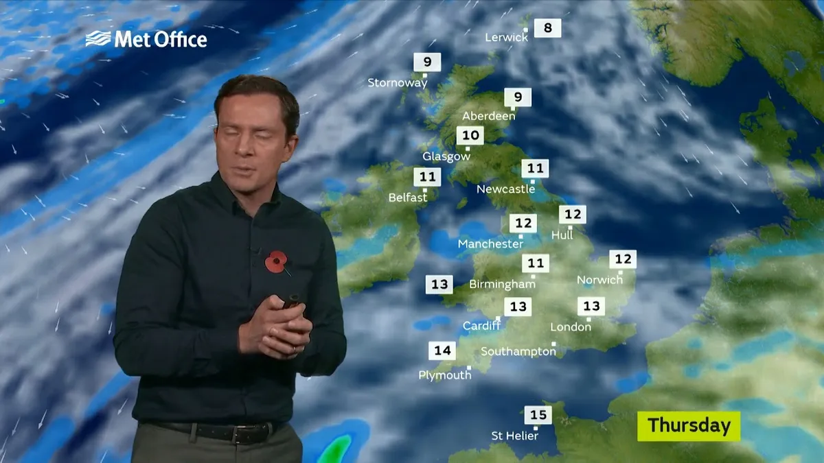
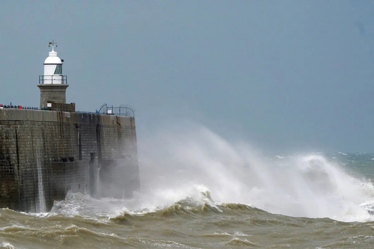
Snow and gale-force winds could return to the UK this week, with the Met Office forecasting a drop in temperatures. Several weather warnings are in place on Wednesday and Thursday, as strong winds of up to 80 mph are possible.
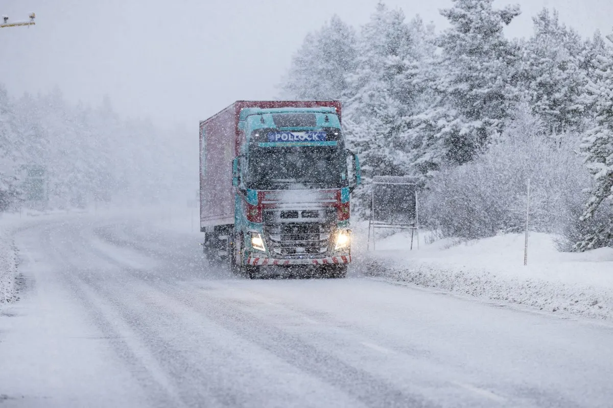
The Met Office has identified northern and western high ground as the areas most at risk of snowfall during brief colder snaps expected through the coming weeks. Mountain regions of Scotland, particularly the Scottish Highlands, Grampians, and Southern Uplands, are most likely to see wintry showers.
A notable shift in wind direction to a north-westerly flow will bring a markedly colder day nationwide on Friday. According to Jason Kelly, chief operational meteorologist for the Met Office, “A notable shift in wind direction to a north-westerly flow will bring a markedly colder day nationwide on Friday, with the potential for a mixture of sunny spells, heavy showers, coastal gales, and snow over high ground.”
Snow is expected over much of Scotland, northern England, and Northern Ireland on Friday morning, with temperatures struggling to get into double digits on Thursday. The Met Office has issued two yellow weather warnings for wind on Thursday, indicating that gusts of 70 mph are expected in northern England and Wales, and 60 mph gusts in Northern Ireland.
As the UK has seen temperatures reach 19.2°C earlier this year, which was the hottest day recorded, the impending cold snap marks a significant shift in weather patterns. The previous hottest day was 18.7°C, highlighting the unusual warmth before this forecasted cold spell.
Temperatures are expected to drop to around 9°C on Friday morning, with widespread snow anticipated in March. Observers note that while temperatures will be near average for the period as a whole, shorter-duration colder interludes could bring frost and hill snow at times.
Weather patterns may become more blocked later in March, increasing the chance of colder conditions developing for a time. However, the exact timing and extent of snowfall in lower areas is unclear, and details remain unconfirmed. Long-range forecasts are difficult to predict accurately, leaving some uncertainty about the weather’s progression in the coming weeks.