The question of how the El Nino phenomenon will affect the UK’s summer weather is becoming increasingly pertinent as forecasts indicate a significant event on the horizon. A rare ‘super El Nino’ is expected to impact Britain’s summer weather, potentially leading to record-level temperatures and altered precipitation patterns.
El Nino is known to be linked to hotter summers and colder winters in the UK. Current forecasts suggest that a potential El Nino during the second half of 2026 could be one of the strongest ever recorded, with a 62% chance of emergence during that summer. This follows the last El Nino event, which occurred in 2023 and led to notable changes in weather patterns globally.
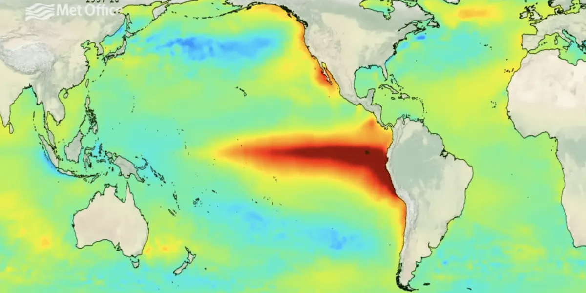
El Nino conditions are characterized by sea surface temperatures rising at least 0.5 °C above the long-term average, and a ‘super El Nino’ is defined by these temperatures spiking up to at least 2 °C. Meteorologists are closely monitoring Pacific temperature forecasts, as the phenomenon is triggered when winds across the Pacific slow or change direction. Grahame Madge from the Met Office stated, “There is a very strong signal that a significant El Niño is likely to develop later in the year.”
Experts like Jim Dale have noted that El Nino tends to increase the chance of hotter weather over Spain and the Continent, which could mean that if the UK experiences a southerly airflow, it may catch some of that warmer weather. David Dixon has also indicated that an El Nino is expected to form by mid-summer, further supporting the likelihood of significant weather changes.
The implications of El Nino extend beyond just temperature increases. The phenomenon can alter jet streams and precipitation patterns, leading to extreme weather events. Tom Di Liberto has remarked, “The stronger an El Nino, the more consistent the impacts we see across the globe.” This suggests that the UK could experience more extreme weather conditions as a result of the upcoming El Nino.
El Nino is part of the El Niño-Southern Oscillation (ENSO) cycle, which also includes La Niña. The last La Niña episode led to cooler temperatures, with impacts ranging from 3 to 5 degrees Celsius cooler than average. In contrast, the current forecasts indicate a significant warming trend associated with El Nino.
While the Met Office warns of potential ‘record-level’ temperatures due to the upcoming El Nino, details remain unconfirmed. The exact impact of El Nino on UK weather will become clearer later in the year, as forecasts in spring may not account for unexpected changes that can happen over the summer.
As the summer approaches, the UK will be watching closely to see how this climatic phenomenon unfolds and what it may mean for the weather patterns across the nation. With the potential for a very strong El Nino, the implications for agriculture, water supply, and public health could be significant, making it essential to stay informed about the developments in this ongoing situation.